Isaiah Bowman's account of the 1911 Yale Peruvian Expedition is structured as a geographical reconnaissance along the 73rd meridian, moving from the tropical Urubamba plains southward to the desert coast at Camaná. The narrative is organized around this transect, with each chapter examining a distinct altitudinal zone or valley. Bowman repeatedly contrasts the 'monotonous browns and yellows of the shimmering desert' with the 'brilliant contrast' of green valley meadows, a recurring visual motif that underscores the region's sharp environmental gradients.
The work's structure reflects its dual purpose: producing a contour map of the two-hundred-mile stretch between Abancay and the coast while also documenting human geography. Bowman admits that 'the map and not the geography was first considered,' yet the text weaves together topographic description, climate data, and observations of isolated communities. The excerpts show a methodical movement between camps—from Abancay at 8,000 feet to Camp 13 at 15,400 feet—with each location's elevation, temperature, and humidity recorded in tables and curves.
A Route Defined by Altitude
The expedition's path is not merely a line on a map but a vertical journey through distinct life zones. Bowman organizes his material by elevation, from the 'montaña' forests to the 'lofty snow-covered passes' of the Maritime Cordillera. At each camp, he notes the elevation in feet and meters, the character of the landscape, and the human response to environmental constraints. For instance, Abancay (8,000 ft) lies in a zone of 'marked seasonal precipitation,' while Camp 13 (15,400 ft) is defined by 'afternoon storms.' The coast at Camaná shows a 'diurnal temperature range of under 10° F' and high humidity, a stark contrast to the interior.
This altitudinal organization allows Bowman to treat each zone as a case study in environmental control. He observes that 'the strong climatic and topographic contrasts' produce 'clear cases of environmental control within short distances.' The reader moves with the expedition from the humid, forested lower Urubamba to the arid, sun-baked desert, experiencing the gradual thinning of vegetation and the increasing severity of weather.
Recurring Images of Contrast and Isolation
Bowman's prose is marked by repeated visual contrasts that reinforce the region's diversity. The desert is described as a 'sun-baked, yellow landscape' interrupted by 'widely separated valleys whose green lowland meadows form a brilliant contrast.' This imagery recurs throughout the excerpts, emphasizing the patchwork nature of habitable land. The Andes themselves are 'aggressive mountains' that 'front the sea in formidable spurs,' a personification that conveys their imposing presence.
Isolation is another recurring theme, though Bowman qualifies it: 'Though we speak of “isolated” mountain communities in the Andes, it is only in a relative sense.' He notes that the extreme isolation of great deserts is unknown here, yet differences in customs and character are 'strongly developed in spite of the small distances.' This tension between proximity and separation is a thread that runs through his observations of human life.
Movement Between Scenes: From Camp to Camp
The narrative is built around the expedition's camps, each a node of observation. Bowman describes the daily challenges of moving between them: 'Camp sites, forage, water, and, above all, strong beasts for the topographer’s difficult and excessively lofty stations brought daily problems.' The text shifts from the detailed records of Camp 13's temperature curves to the broader view of the 'Peruvian Landscape' in Part II, where Bowman steps back to describe the Cordillera as seen from the coast.
This movement between the specific and the general gives the work a layered structure. The reader is first immersed in the immediate data of a camp—its elevation, weather, and local features—then lifted to a panoramic perspective. Bowman's description of the west-coast landscape, for example, begins with the traveler's first impression of 'nothing but disorder' before analyzing the underlying regularity of the mountain forms.
The Role of Climate Data in the Narrative
Bowman integrates quantitative climate data directly into the geographical description. Temperature curves for camps like Cotahuasi and Salamanca are discussed in the text, with notes on humidity and diurnal range. For instance, he observes that 'the single day’s record shows the characteristic effect of cloud reducing the maximum temperature' at Abancay. These data points are not relegated to appendices but are woven into the narrative as evidence for the environmental control he posits.
The inclusion of such data reflects the expedition's scientific purpose, but Bowman also uses it to highlight contrasts. The coast at Camaná, with its 'high relative humidity, over 70 per cent,' is juxtaposed with the interior station at Aplao, which has a 'greater range of temperature.' These comparisons reinforce the book's central argument about the diversity of Andean environments and the human adaptations they require.
Bowman's reconnaissance is best approached as a field notebook that balances precise measurement with descriptive geography. The reader should attend to the interplay between the expedition's practical constraints—the need for forage, water, and strong beasts—and the broader patterns Bowman discerns. The work rewards those who follow the altitudinal transect from the Urubamba to the coast, noting how each camp's data contributes to a cumulative portrait of a region where environmental control is both stark and subtle.
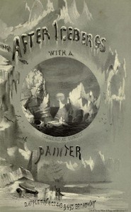
There’s something about Bowman’s dry riverbeds and wind-scoured passes that stays with you, a quiet ache for places that barely hold a footprint. I found that same lonely tenderness lingering in a painter’s voyage to Labrador, where the ice seems to remember every lost summer. Both books feel like old photographs, faded at the edges. After Icebergs with a Painter A Summer Voyage to Labrador and Around Newfoundland. — Reading Companion keeps that particular light.