About 308 minutes
The cave dwellers of Southern Tunisia — A Closer Reading
Geography
70,769 recorded words. 2 minutes difference from this book's estimate.
View Gutenberg source #71585
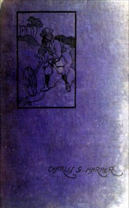
The catalog record for The Holyhead Road: The Mail-coach Road to Dublin. Vol. 2 — A Reader’s Guide provides practical reading context through 71,082 words, 5 hr 10 min estimated reading time, and 64 detected text sections.
The text analysis averages about 22.7 words per sentence, while the detected sections provide another way to judge how the source is divided.
Project Gutenberg metadata also associates the work with “England -- Description and travel,” connecting these edition facts with the source record’s subject description.
Explore this collection
These alternatives are selected using recorded categories and estimated reading time.
About 308 minutes
Geography
70,769 recorded words. 2 minutes difference from this book's estimate.
View Gutenberg source #71585About 290 minutes
Geography
66,589 recorded words. 20 minutes difference from this book's estimate.
View Gutenberg source #66295About 287 minutes
Geography
65,854 recorded words. 23 minutes difference from this book's estimate.
View Gutenberg source #71965Search stored excerpts and compare books → Choose by your preferences →
Choices use stored catalog measurements. Estimates vary with reading speed. A shared category is a catalog label, not a claim that two books have the same argument or literary quality.
Search reads excerpt text stored with this catalog and links to its associated Gutenberg record. The connection is stored in the site database; this tool does not recheck that every excerpt is word-for-word identical to that external record. Excerpt search does not cover every chapter and does not verify historical publication dates.
Catalog snapshot checked: 2026-09-25. Coverage: 97 public books, 97 available source excerpts.
Calculated from edition completeness, EPUB availability, text structure and catalogue metadata. Not a user rating.
Total of 100 points, scaled to a 2.5-5.0 range. Editions with an empty description or a missing EPUB file are not scored.
Public-domain source text
The source text is kept in the dedicated reader, separate from this catalogue record and its commentary.
Charles G. Harper's second volume of The Holyhead Road picks up the route at Birmingham and pushes westward through the Black Country, Shropshire, and into North Wales. The excerpts show a writer as attentive to the present state of the road as to its history: he notes the ruts and grass of a disused track, the loneliness of a toll-house keeper, and the precise terms of a land gift from the Lovett family in 1820. Harper's voice is concrete and occasionally wry—comparing a ruined canal-side settlement to a deserted California mining town, or calling Henry II 'the Buller of his age' for his poor generalship. The book is less a systematic guide than a discursive journey, rich with local anecdote and the material remains of coaching days.
Harper devotes careful attention to stretches of road that have been superseded. In Shropshire, he describes a track 'in every rut proclaims “old road,” and “disused” in the grass and rubbish.' The new Parliamentary Road, broad and straight, bypassed it entirely. At the far end, rotting canal wharves and a row of cottages stand as evidence of a vanished traffic. The toll-house at Belmont Bar, built on land donated by the Lovetts with a reversion clause, became private property after the gates were abolished in 1883. Harper sketches the old man who lives there rent-free, his only excitement the tramps who try the doors at night. One anecdote tells of two navvies and a woman who camped in the garden, were taken in, and left a gift of sugar, loaf, and tea. Such vignettes give the road a human texture absent from official histories.
At the 'Bridge Inn,' where the old road meets the new, the River Ceiriog foams in its ravine. Crossing the bridge puts the traveller into Denbighshire and Wales—but only after a steep climb to Chirk. Harper notes that the village crowns a plateau, and Chirk Castle commands a cleavage in the hills where Castell Crogen once stood. He recalls the battle of Crogen, fought seven hundred years earlier when Henry II led his army this way. The king's choice of route is criticised: 'Henry Plantagenet was the Buller of his age, and his rank bad luck and ill generalship combined caused him to lead his army the hardest way.' Harper's eye for military topography—the 'readiest road by which to enter North Wales'—shows how the coaching road followed ancient lines of movement, and how the landscape still bears the marks of medieval conflict.
The Project Gutenberg record lists subjects: 'England — Description and travel; England — Social life and customs; A5 Road (England and Wales).' The excerpts confirm that Harper describes places along the A5 corridor, but they also show a book far more discursive than a modern travel guide. He lingers on abandoned infrastructure, toll-house contracts, and the sound of tramps at night—details that belong to social history rather than straightforward topography. The catalog does not capture the book's strong narrative voice, its dry humour, or its willingness to digress into medieval battles and canal decay. Readers expecting a dry road log will find instead a layered account of how a route accumulates stories. The excerpts, however, cover only a few pages; the full volume may shift tone or structure in ways these samples do not reveal.
Harper's second volume rewards readers who enjoy unhurried observation and a willingness to stop at the side of the road. The excerpts suggest that the book is best approached not as a systematic itinerary but as a series of linked essays on place and memory. Pay attention to the small details—the reversion clause, the gift of tea, the rutted track—because they are where Harper's real interest lies. The catalog subjects are accurate but incomplete; the book's character emerges from its digressions.
Reading about the coach road’s abandoned stretches and quiet toll-houses, I kept thinking of the dusty, overlooked paths in To Mesopotamia and Kurdistan in disguise — Reading Notes. Both books seem to prefer the forgotten corner over the grand destination, finding more truth in a broken milestone or a shuttered post than in any monument. A gentle companionship of place.
Create a short personal record of your experience with this book.